Industry developing creative solutions for GPS-denied environments
StoryNovember 20, 2023

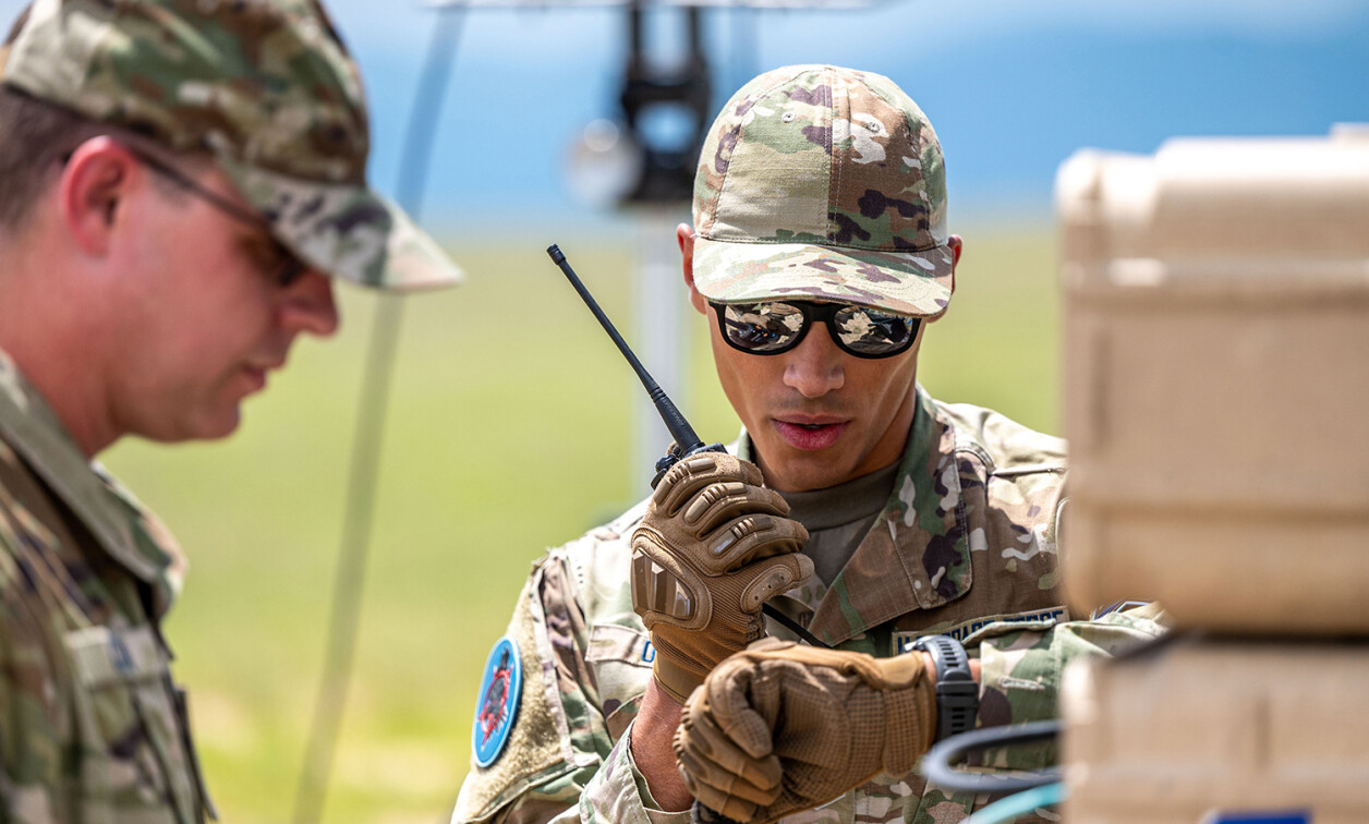
In modern warfare, where signal jamming is now as common as bullets and bombs, the ability to navigate without the guiding stars of GPS has become a critical survival skill for today’s soldier.
The modern battlefield has evolved into a complex chessboard where the traditional lines of navigation and communication are constantly being blurred and disrupted.
As adversaries grow more adept at blocking GPS signals, the U.S. military is turning to advanced soldier-navigation equipment. Technology like soldier-to-soldier wireless communications, body area networking, and battlefield power storage and generation are at the leading edge of this effort.
These innovations are not just about keeping soldiers connected; rather, they are about redefining the very fabric of military strategy and operations in environments where the traditional tools of navigation and timing are rendered obsolete.
Diverse environments – from the dense canopy of forests to the steel canyons of urban sprawl – demand precision, adaptability, and the relentless pursuit of innovation within the stringent constraints of demands for every-smaller size, weight, and power (SWaP).
The answers lie not only in the hardware but in emerging tech like artificial intelligence (AI) and machine learning (ML), where the rapid processing of sensor data and sensor fusion on mesh networks can help create accurate positional fixes.
“If soldiers share a common mesh network and a single soldier on the network has generated a reliable position fix, the position of all other soldiers on the network are instantly known,” says Chris Hohne, a principal engineer at Benchmark Secure Technology (Santa Ana, California),. “If a soldier is on the edge of a network and is only visible to one or two nodes, position information will be degraded, and the map will show a large area of uncertainty. However, if more than two nodes are visible, position accuracy will exceed that of GPS.”
Strategic and technical obstacles
While companies are forging ahead with solutions like these, there are some broader strategic concerns. Dana Goward, president of the Resilient Navigation and Timing Foundation – an organization that aims to protect critical infrastructure by promoting resilient navigation and timing worldwide – says there are inherent risks in the U.S. Department of Defense (DoD) strategy when it comes to GPS.
“There is a lot of technology available that can make it more difficult to interfere with GPS receivers,” Goward says. “This is important because DoD has said that GPS is going to be the centerpiece of its PNT efforts going forward.”
The emergence of complementary and alternative systems can help, but the DoD has not provided any direction on the way forward, Goward says, attributing this to a lack of leadership support for alternative systems – a situation that could leave the military at a disadvantage if GPS systems are compromised. (Figure 1.)

[Figure 1 ǀ There are some potential risks in making GPS the centerpiece of governmental PNT efforts, says the president of the Resilient Navigation and Timing Foundation.]
These alternative navigation options aim to deal with a wide range of technical challenges facing today’s soldiers. The need for precision and accuracy in position and timing data is driving much of the development, Hohne says, adding that the variability of environments – such as urban areas, forests, or oceans – adds complexity.
“The biggest challenges to developing solutions for GPS-denied environments are the wide range of products that must be supported, variability of the environment in various theaters of operation, and SWaP [size, weight, and power] considerations,” he continues. “Many of our systems have been designed to operate with an embedded GPS receiver that is smaller than a quarter and sips power.”
The technical obstacles are not just about navigation, but also about ensuring that military systems can access data regardless of GPS signal status, says Matt Sieber, director of DoD programs and requirements at Kymeta (Redmond, Washington). The challenge: to balance the precision of A2-PNT solutions with affordability for the DoD, he adds.
Distributed AI and ML have been game-changers, enabling rapid processing of sensor data and facilitating sensor fusion for accurate positional fixes, Hohne notes. These technologies can adapt to different environments, thereby improving navigation accuracy by weighing sensor inputs based on their reliability.
“AI/ML can also facilitate sensor fusion, where data from various sensors are combined to create a more accurate and reliable navigation solution,” he adds.
Open standards such as the Sensor Open Systems Architecture (SOSA) Technical Standard will be key for helping the military develop systems that can tackle the challenge of GPS-denied environments in the future. SOSA enables rapid iteration and evolution of systems, Hohne says, noting that in the context of GPS-denied operations, no single product will suffice – instead, a system of products that can quickly adapt and evolve as threats shift is necessary.
“Open standards like SOSA are critical to this effort because they provide a mechanism for a ‘system’ to rapidly iterate and evolve,” he continues. “SOSA and other open standards break vendor lock and provide a method for the combined intellect of our nation and our allies to develop solutions, drop them into the existing weapon systems, and verify that they solve today’s problem. SOSA systems then allow the existing weapon systems to be upgraded in hours instead of days or weeks.”
Managing power consumption
As interesting technologies continue to emerge, power consumption remains one of the more difficult elements to deal with. Hohne says his company’s MicroRadio design is engineered to minimize power consumption through design trades, optimization of embedded software, and management of RF power output.
“MicroRadio was specifically designed to reduce power consumption and extend operation on a small, internal battery,” he says. “Design trades, iteration, and evolution allowed us to shrink the design down to a small group of low power components, optimize embedded software/firmware and algorithms, manage RF power output, and minimize and aggregate background processes.”
For its part, Kymeta’s Osprey u8 HGL system uses holographic beamforming techniques, which require significantly less power than traditional phased-array solutions, often operating on the vehicle’s native DC power without additional equipment, Sieber says. (Figure 2.)

[Figure 2 | The Osprey u8 HGL on-the-move terminal is designed to work irrespective of GPS signal availability.]
“Osprey u8 HGL differs from many of the traditional phased array solutions coming to market in the near term by employing holographic beamforming techniques using a passive metasurface antenna,” he says. “One of the main benefits of this technology is that it uses 1/2 to 1/10 of the power consumption required by competitor products.”
The future of sensor navigation
Improving sensor navigation is a continuous effort, and the industry must design systems that can integrate new sensors and systems as they become available. By designing them to be plug and play, soldiers can take advantage of new technologies such as video sensors, accelerometers, gyroscopes, and magnetometers almost immediately.
“New sensors and systems can be integrated to the soldier by simply attaching them to the vest, placing them in a pocket, or wearing them as an article of clothing,” Hohne says.
Hohne says he envisions a future where distributed AI/ML will be the cornerstone and regards the evolution of data collection, storage, and distribution as critical to developing robust tactical-edge military models.
The growing number of low Earth orbit (LEO) and medium Earth orbit (MEO) satellites is a big benefit to the sensor-navigation industry, Sieber says. He predicts that the ability to use noncooperative or nonstandard signals from these satellites for precise location and navigation services, combined with an alternate solution for precise time, will significantly reduce the DoD’s reliance on GPS.
“The number of low and medium Earth orbit satellites in space is blossoming at a pace inconceivable just a few years ago,” Hohne asserts. “There are several companies pursuing efforts to use non-cooperative signals of interest from GEO, LEO, and MEO satellites to determine a precise location and navigation services.”
Goward agrees that these satellites could be critical in the future: “If there is a leader among all the systems, it is probably PNT from low Earth orbit satellites: better than GPS, more powerful signal, potentially even more accurate,” he says.
However, he cautions that while LEO satellites offer signal diversity and coding advantages, they share common failure modes with traditional GPS due to their very nature as satellites. This reality means that designers must consider the difficulty in preempting and preventing disruptions: “Fundamentally, people just have a hard time getting ahead of the bang and preventing bad things from happening.”